Best hikes in the world
Here is an overview of the best hikes in the world according the travel bloggers. I hope you find some inspiration for your next travels.
Best hikes in the world: Asia and Australia
Noosa National Park, Australia (Thrifty Family Travels)

One of my favourite places to hike is through the Noosa National Park on Australia’s Sunshine Coast, because you get a little bit of everything – bush, wildlife, stunning coastal views and several spots to swim.
There are 5 different walking track options in Noosa National Park ranging from a short bush walk to a few hours hike. The official entrance/starting point is along Park Road not too far from Hastings Street, this is the ideal spot if you want a short walk. However, for the longest walk, the Alexandria Bay track, I like to start from the Sunshine Beach end.
The Alexandria Bay track is 4.6 kilometres and incorporates the popular 2.7 kilometres coastal track which takes you past all of the stunning Noosa National Park beaches as well as the Hells Gate’s lookout point. We like to pack some snacks and stop at the various beaches along the way making it into a good half day trip.
Whilst inland keep your eyes peeled for koalas, echidnas, giant monitors, and birdlife. Whilst along the coastal track you can spot marine life such as dolphins, turtles and manta rays.
Kings’ Canyon, Australia (The Travel Fairies)
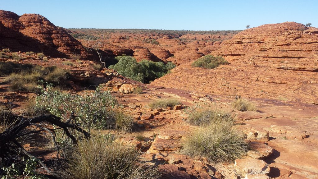
Over the years I’ve been on many hikes through several different environments but my favourite of all time is Kings’ Canyon in Australia’s Northern Territory. At the canyon itself, there are several different walks with varying length and difficulties but the one I did was the Kings’ Canyon rim walk. This is the most popular route and of medium difficulty. The 6km hike takes at least 3-4 hours to complete and it is recommended to start early as there’s little shelter and the canyon can get pretty hot by noon. You need to take at least 2 litres of water with you or 4 on a hot day as there’s nowhere to fill bottles up during the hike. There is a steep stair climb up Heartbreak Hill, to begin with, but from there on the walk is relatively flat. These steps can be pretty tough going but with a little bit of patience and plenty of short breaks people of pretty much, any fitness level can make it.
My favourite thing about this walk is that every step you take brings you to something new and interesting. You will pass through Priscilla’s Gap (made famous from the film Priscilla: Queen of the Desert), The Lost City (a series of rock domes that look like the houses of a lost civilization) and the Garden of Eden (a lush secret rainforest found by a short detour). But by far my favorite thing at Kings’ Canyon is the fossilized fish, shells and wave ridges in the rock. These were formed thousands of years ago when the center of Australia used to be covered in a huge inland sea and it’s fascinating what has been preserved as the sea level dropped.
The Great Ocean Walk, Australia (Heading for the Hills)
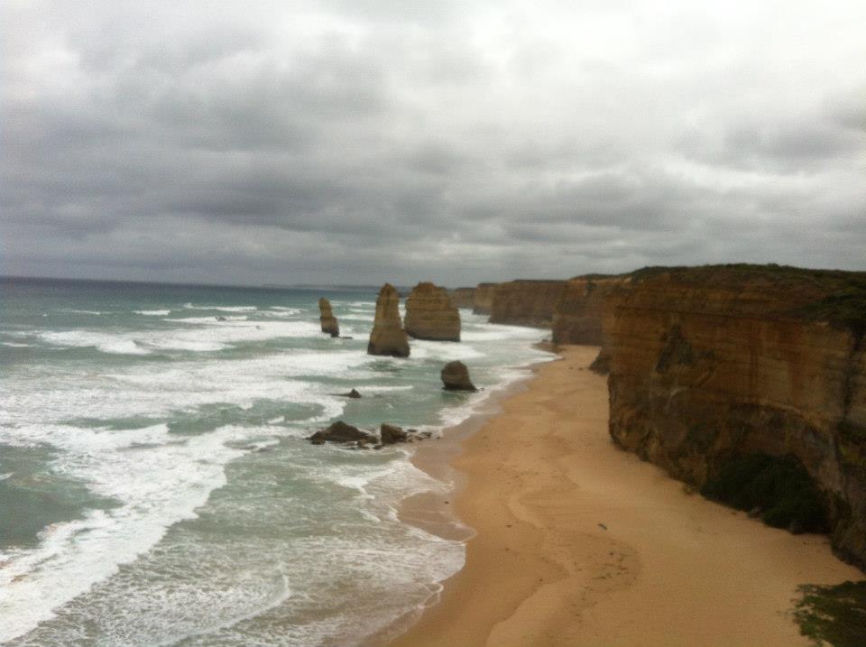
The Great Ocean Walk is a brilliant 100km walk through the Otway National Park from Apollo Bay in western Victoria, Australia to the infamous 12 Apostles near Port Stephens.
This walk is stunning! It doesn’t get more spectacular than a rugged coastline with incredibly perfect clifftop coastal views, abundant wildlife, and amazing beach walks.
I hiked the Great Ocean Walk from end-to-end over five days, walking around 20km each day. The terrain and fauna changed each day – starting with towering gum trees and tree ferns in a temperate rainforest to the tea trees and bush scrub. The walk is undulating, from sea levels to cliffs no more than about 300m above sea level, so you’re never having to climb for too long. The ascents and descents are quite gentle, apart from the infrequent uphill sandy sections. Sand is always much harder to walk in than a firm track underfoot.
We saw so much native Australian wildlife – from koalas and kangaroos to shy echidnas and a crazy seal that greeted us from a beach cave … and we tiptoed around lots of snakes!
It’s free to hike the Great Ocean Walk, but you need to book and pay for campsites along the way. We stayed in a comfortable caravan park near Apollo Bay and used a shuttle service to drop our car off at the end of the day’s walk, so it would be ready to bring us back to our accommodation. The hike is really well sign-posted and the tracks easy to follow. We brought a map and directions with us but really didn’t need it.
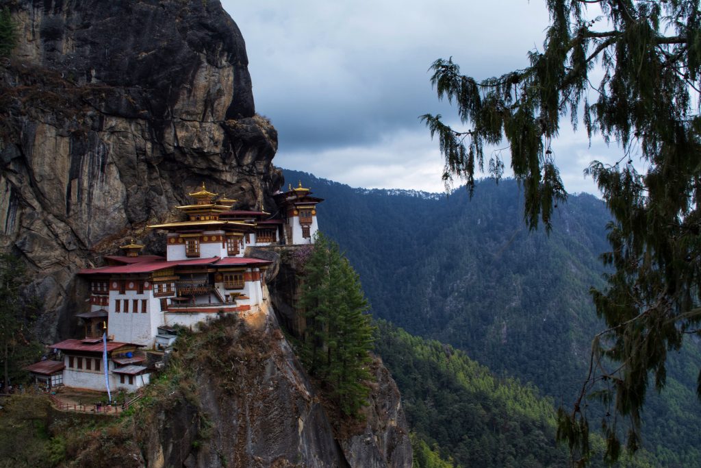
Tiger’s Nest, Bhutan (Speck on the Globe)
Suicide Cliff, Hong Kong (Wander with Jo)

Har Ki Dun trek in Uttarakhand’s Himalayas, India (Oindrila Goes Footloose)
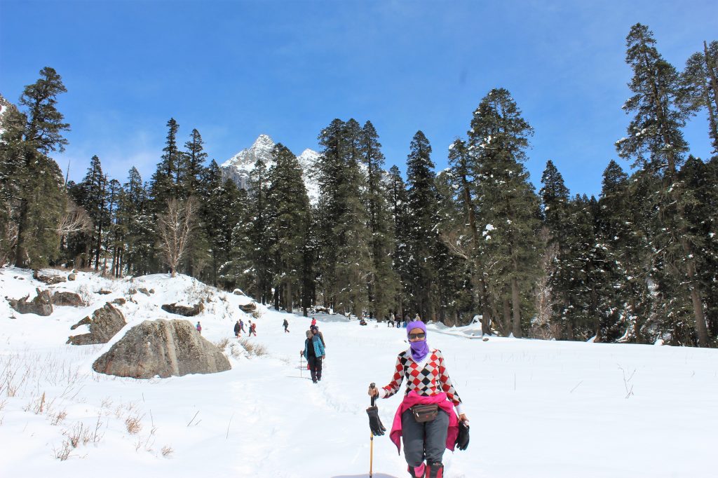
The longest range of mountains in Asia, the Himalayas, has numerous hiking trails for those who long to escape civilization and experience tranquillity in the lap of rugged terrain. Har Ki Dun is a beautiful trek in the Uttarakhand state of Northern India that takes you through villages that are off the grid, snow-capped peaks and verdant meadows. This 70km trek is of easy-to-medium level difficulty and takes 4 to 6 days to complete. While summers let you see a lot of colourful rhododendrons and swathes of emerald green fields, the winters help you beat the hiking rush and enjoy the immaculate white snow on most of the days.
To start the trek, fly to Dehradun in the evening and prepare for a long road journey the next morning. Leave early next day for Sankri so you can reach this village by sunset. Next morning, hike to Taluka village (or alternatively, hire an offroader if you wish to begin your hike from there on the same day). From Taluka trek for 8 hours to Pauni Gherat and camp there for the night. You can also visit the nearby village and check out an ancient watermill that uses hydroelectric power from the gushing stream to grind grain to flour. The next day, hike to Kalkattidhar and camp in the snow. Next morning, hike to the Har Ki Dun peak and follow the same trail back to Kalkattidhar (and take the same route for the next 2 days back to Sankri).
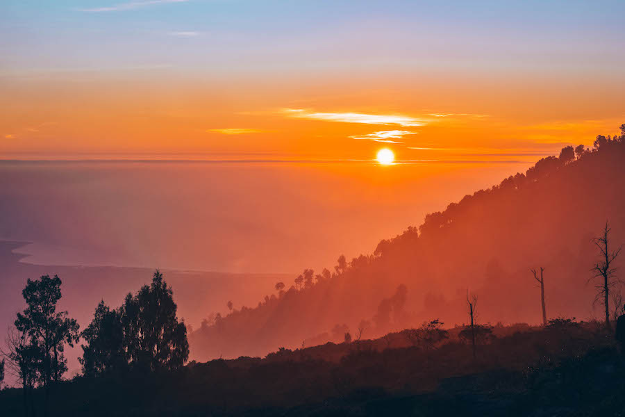
Kawah Ijen, Indonesia (Greta’s Travels)
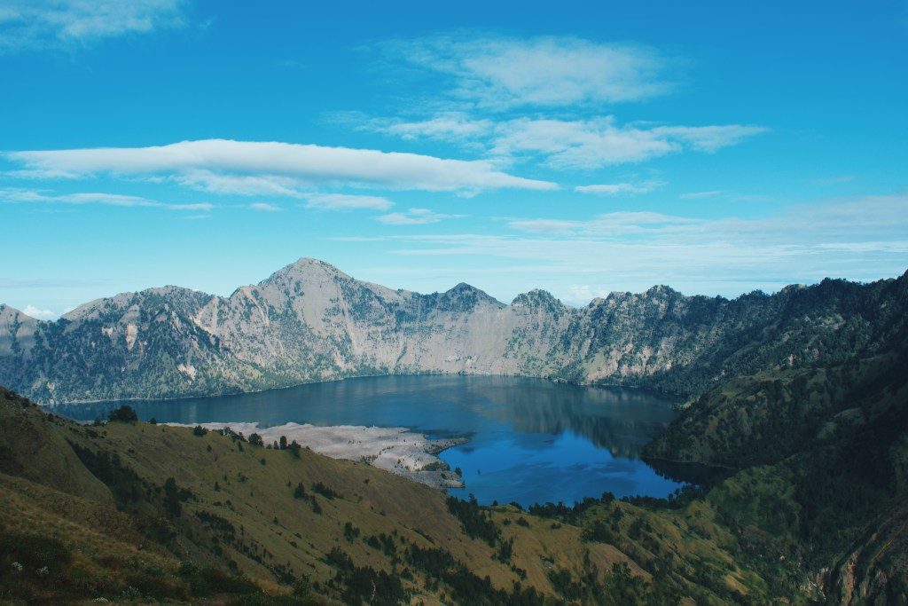
Mount Rinjani, Indonesia (Gamintraveler)
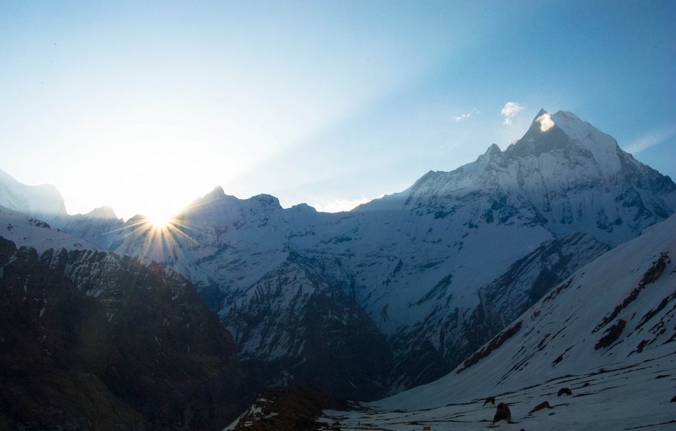
Annapurna Circuit, Nepal (Be My Travel Muse)
Jiri to Everest Base Camp, Nepal (Our World to Wander)
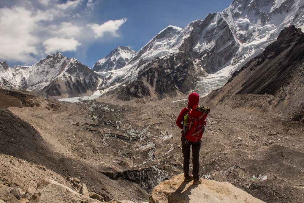
Nepal is known for its incredible treks. I mean, of course, it’s home to the mighty Himalayas, so it’s natural to have jaw-dropping mountain trails. The best part about trekking in Nepal is that you can choose from three-day treks to one month long treks. You can easily find something to suit your fitness level and the number of days of your holiday.
But after having done four different treks in Nepal, my favourite one is the more extended version of Everest Base Camp, via Jiri, a 29-day trek that will make you fall in love with the Himalayas forever and ever. The number of days in which you can do this trek varies a lot, depending on how many side trips you want to include and also how many rest days. To stay safe from altitude sickness, it’s important to rest properly.
I chose this trek because I am afraid of flying in Nepal, those tiny planes scare me like hell. So instead of taking the classic Kathmandu-Lukla and return, we took a bus to Jiri and started trekking from there. In this way, by the time you reach Lukla (after around five days) you are already trained for the rest of the trek.
I decided to include a detour to Gokyo Lakes and climb Gokyo Ri and thank God for this. Because the views from the top of Gokyo Ri are much better than what you get at Everest Base Camp. And for sure less crowded.
This trek is a perfect cocktail of various landscapes, from mossy forests to giant snow-capped peaks, Buddhist monasteries, Sherpa villages, massive glaciers and glacier lakes, high passes. And you get to wave to the world’s highest mountain, the famous Everest.
Gokyo Ri Trek, Nepal (Fox in the Forest)
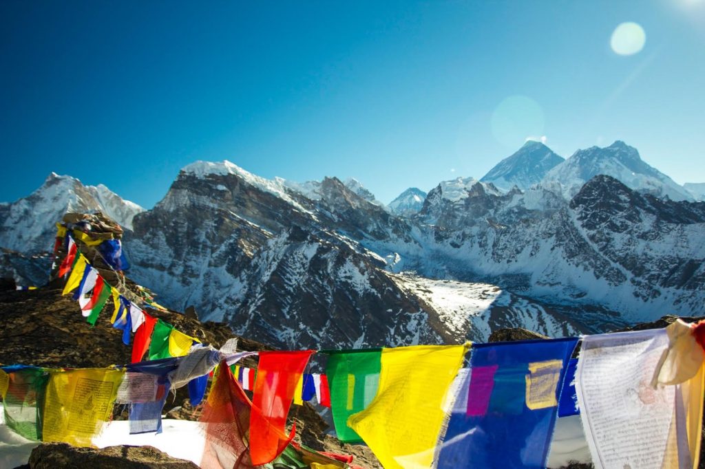
If you are on the hunt for the best view in the Himalaya look no further than Gokyo Ri. This lesser-known, 14-day trek travels deep into the Himalaya. The climb culminates at the top of Gokyo Ri, a 17,775-foot mountain nestled in the Khumbu Region.
From the top, you are treated with a 360-degree view of the best of the Himalaya. From here you can see Mount Everest and several other 8,000m peaks including Lhotse, Makalu, and Cho Oyu. If you dare to look down from this high-altitude perch, you can also see the Ngozumpa Glacier, which is the largest in the Himalaya.
The trek starts with a thrilling flight into the famous Lukla airport. Once you step off the plane, the next thing to do is the hike. This trail follows the iconic Everest Base Camp route all the way to Namche Bazaar, a sprawling, horseshoe-shaped town in the Khumbu. From there the trail deviates from the Everest Base Camp “highway” onto a smaller, quieter trail.
You continue your upward climb for several more days until you reach the town of Gokyo, one of the highest human settlements in the world. Along the way, you will pass six sacred lakes that Gokyo is famous for.
For an added treat, start your climb up Gokyo Ri before dawn and witness the sunrise over Mount Everest.
Poon Hills, Nepal (Deafinitely Wanderlust)
Pic N’ga, New Caledonia (Out Chasing Stars)
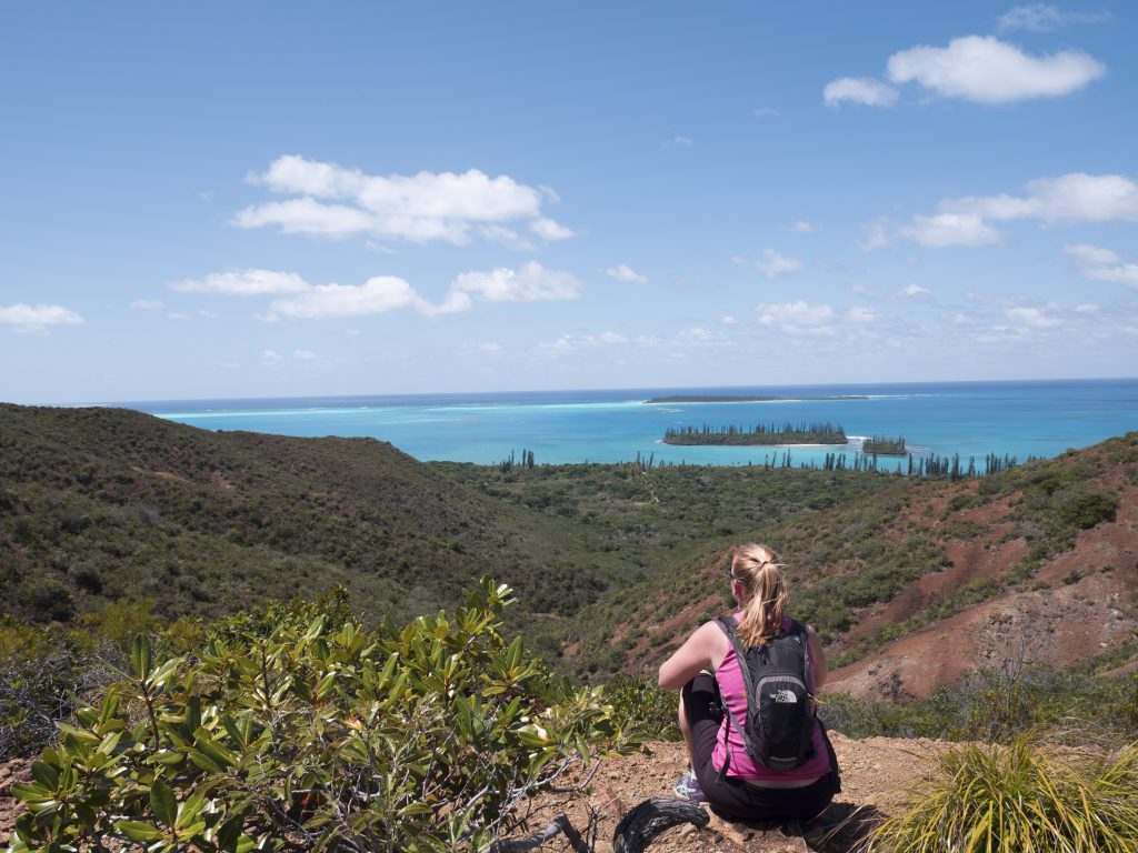
In the largest lagoon in the world lies Iles des Pins – Isle of Pines – in New Caledonia. The island is a popular stop on the cruise ship circuit, but rarely do those guests venture up to the tallest point of the island to enjoy one of the most spectacular views I’ve ever seen. Pic N’ga takes about two hours to hike return and is fairly steep. At the base is an old barrel holding suitable walking sticks. Take one if you’d like but don’t forget to return it! The start of the hike wanders along a dry creek bed.
Once you break through the trees, the rest of the hike is exposed to the sun, meaning it gets hot so water and sunscreen are a must. There are several stopping points along the way, providing views over the nearby bays: Baie d’Upi, with its traditional outrigger canoes sail; Kuto Bay, where the cruise ship makes port; and even all the way out to the mainland of New Caledonia. The top of Pic N’ga has a large cross mounted. Tokens from travellers (mostly small coins) are wedged into the wood of the cross or left at the base. We took our time at the top, enjoying the scenic views of the reefs and the neon water that a cloudless day gave us.
Milford Track, New Zealand (Walk My World)
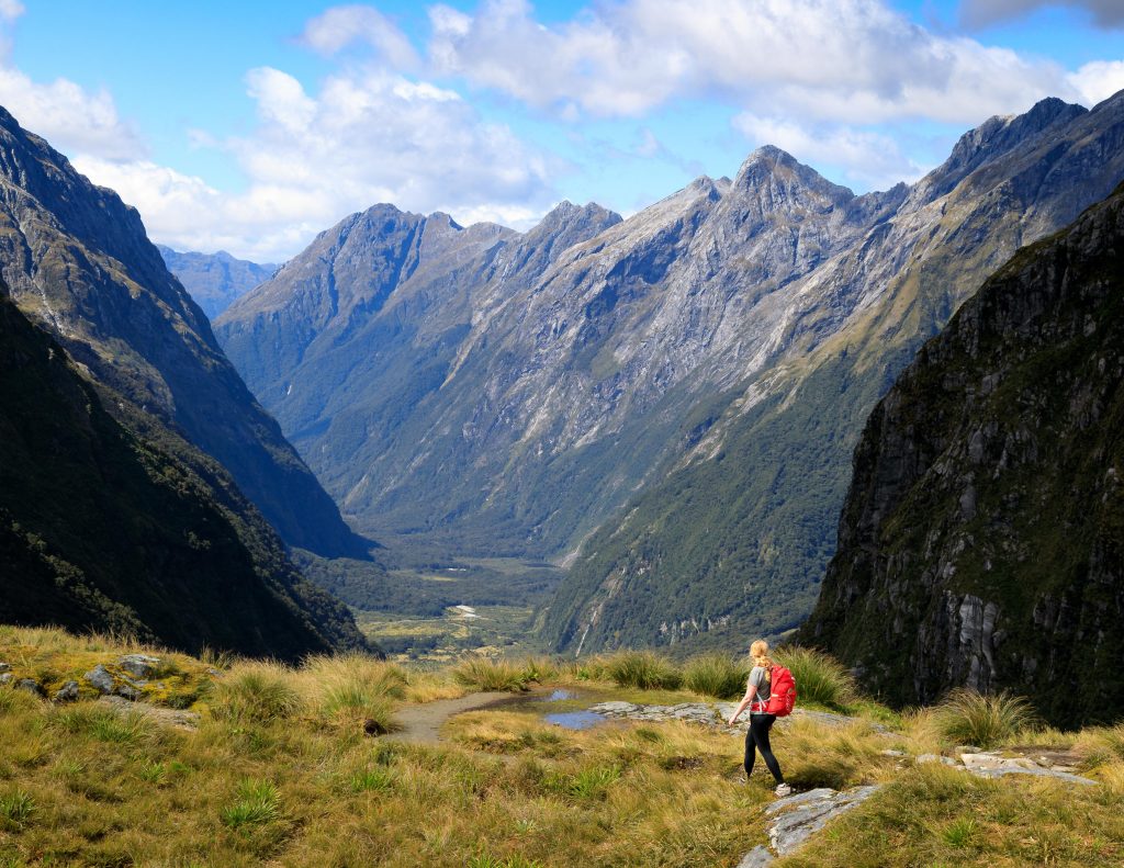
Known as the ‘finest walk in the world’ the Milford Track is the most famous walk in New Zealand, a country known for incredible hiking. It sells out for an entire year the day that hut slots become available. With all that comes very high expectations, luckily this is one track that will definitely not disappoint.
The 53.5km four-day hike in Fiordland National Park takes you through a pristine forest that make you feel like an extra in The Lord of the Rings, glorious mountain ranges and even to the highest waterfall in New Zealand, Sutherland Falls. The beautiful thing about this walk is not just the scenery, which is out of this world, but also the whole experience. Due to numbers being strictly controlled (only 40 independent hikers per day) it means you spend each night in the huts with the same people, which leads to forming some great relationships. Bird watching, glow worm hunting and star gazing are all part of the experience that no one usually mentions but would be attractions in themselves in most parts of the world.
It’s not known for its good weather, and you will likely experience rain and lots of it. We had 1/3 the annual rainfall of London in one day on our hike, once you get over the sodden boots it all starts to feel like an incredible adventure. The mountains come to life with thousands of new waterfalls forming, in fact, I think this is one of the only walks in the world where you actually want rain!
If you want to walk in one of the most beautiful places on the planet, head for the Milford Track.
Hooker Valley Track, New Zealand (My Wanderlust)
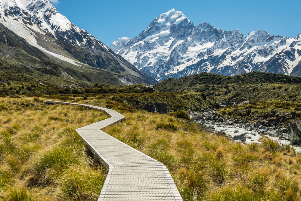
Everyone always kept telling me how New Zealand is the most beautiful country in the world. To be honest I didn’t really believe it. But then I went, saw Hooker Valley track on one of the first days of my 10 days in New Zealand, and fell in love with the place. The track starts near Mount Cook village, not far from the town of Twizel (where I based myself and did the track as a day trip) and close to the famous and beautiful Lake Pukaki. It’s a very easy track, I with my very poor condition did it without any problems, the total length one way is 5kms.
The return trip took me around 4 hours but only because I was stopping every few minutes to take a picture. During the whole hike, I felt like I’m walking in the Photoshop, that’s how stunning the place was. I don’t think I’ve ever seen such an easy track in such an incredible landscape around. The end of the track is at the Hooker Lake with the splendid views of Mt. Cook – the highest mountain in New Zealand. You have to return the same way but the place is too beautiful it never gets boring.
If you have some extra time there is also the Kea Point nearby that apparently offers really good views of Mt. Cook too, the starting point is at the same place as the Hooker Valley track starts.
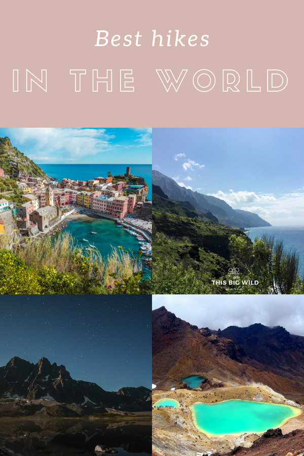
Tongariro Crossing, New Zealand (Migrating Miss)
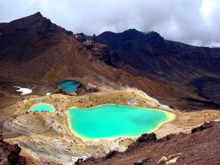
The Tongariro Crossing in New Zealand is one of the best day hikes in the country, and one of the best in the world! The 19.4-kilometre walk includes the ascent and descent of Mount Tongariro, an active volcano, alongside steaming vents, colourful crater lakes, ancient valleys and other alpine terrains. The walk is challenging, thanks to the mountainous terrain, and you should allow a full day to complete it. In the summer the trail can be busy as the walk has become more and more popular with tourists and locals alike.
The Tongariro Crossing is a one-way trail so you need to organize transport from the end back to the beginning if you’ve left a vehicle there, and in summer there are further parking restrictions which mean you need to organize a shuttle from a nearby town. The area is notorious for fast-changing weather, so you need to be vigilant in checking the forecast and be prepared to turn back if the weather becomes bad after you’d begun the walk. I attempted it twice before I finally managed to finish it! The Tongariro Crossing is one of the best walks I’ve ever done because of the diverse terrain and the epic views.
Roys Peak, New Zealand (Swing Abroad)
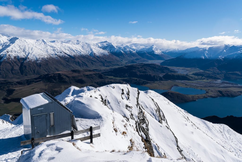
You can never say that you visited Wanaka without hiking Roys Peak. Arguably the best single-day hike in New Zealand, Roys Peak is located in Wanaka at an altitude of 1578m. It requires around 5 hours to hike from the lake at the foothill. Passing through various farmland with sheep poos all along the trail then up into the tussock tops to the summit.
The best thing about Roys Peak is the 360-degree panoramic view at the summit. Imagine being surrounded by snowy hills and huge lakes, looking at the nearest town at the height of an eagle. It’s the best reward for all the sweats during the hike. Be sure to bring a lunch box to the summit and enjoy picnicking with other fellow hikers.
In terms of difficulty, the hike is 3 of 5 stars in my opinion. It doesn’t require any professional skills but having good stamina is important here. From the foothill to the summit, there is a 1228m change of elevation. The trail is completely steep most of the time so you might need a lot of rest along the way with bad stamina.
To get there, first, you will need to get to the parking lot at the foothill from Wanaka town. It’s not far at all so you can easily reach there if you have your own vehicle.
Roys Peak, New Zealand (Ponytail Pretty)
It is certainly no secret the beauty New Zealand holds throughout both islands of the country. Full of diverse landscapes it’s every outdoor lover’s dream! From rugged mountains and lush forest to dreamy coastal shores, the country has it all. Throughout are beautiful trails to be hiked and views one might only dream of.
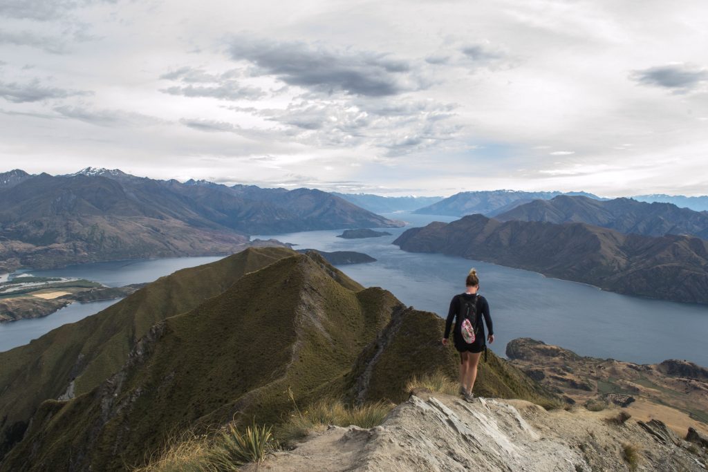
In New Zealand’s south island lies one of the best day hikes in the world, Roy’s Peak. Widely known for the infamous photo at the end of the peak and stunning views of Lake Wanaka, the walk makes you work for every single bit of it.
The track itself is classified as easy. It is wide and open, 4WD groomed track, going uphill the entire time. The hike though is rated difficult as it is a steep uphill climb the whole way. Switchbacks cover the mountainside from top to bottom with sheep popping their heads up as you walk by. The walk is 16 km round trip and you return the way you came taking the average hiker 5-6 hours. It is important to note that because this walk is on private land to respect the livestock (mainly sheep) that are grazing and that it is closed from October 1 to November 10 each year for lambing. The climb is a hard one to make sure you’re well prepared with good footwear. Because the track is open and can get quite windy and chilly at the top, even in the middle of summer, always pack extra layers and lots of water is a must!
This hike is absolutely stunning from any part of the track. Be sure to climb right to the summit of Mt Roy for 360-degree views. Your legs may hate you later but it is worth every minute of it!
Tasman Glacier Hike, New Zealand (Travellers Archive)
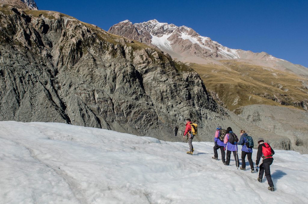
The Tasman Glacier Hike in New Zealand will make you wander about the fact, how beautiful nature actually is. The Tasman Glacier is located on the Southern island of New Zealand and is the country’s largest glacier. It flows south and east towards the Mackenzie Basin from the Southern Alps. In total it has a length of 23.5 kilometers and lies entirely within the borders of Aoraki/Mount Cook National Park.
Hiking the Tasman Glacier means a lot of adventure. You will hop on a helicopter that will take you from the heart of Mount Cook right into the glacier. Before actually taking of, you’ll get an introduction into glacier hiking and prepare yourself and your clothes for the hike. It usually only takes a couple of minutes to get up to the glacier. The hike itself is mostly guided. Within two hours you’ll hike up and down and into the hike, relying on the safety of the spikes on your shoes. It’s a stunning experience to walk right into a glacier and teaches you a lot about the environment and climate change.
When it comes to the difficulty level, you don’t need to be super fit, but you should be able to walk up and down without losing your balance.
Should you do the hike when you are in New Zealand? Yes! If there is one exciting thing you want to do in New Zealand, then it should be this hike.
Ella Rock, Sri Lanka (The Foodie Miles)
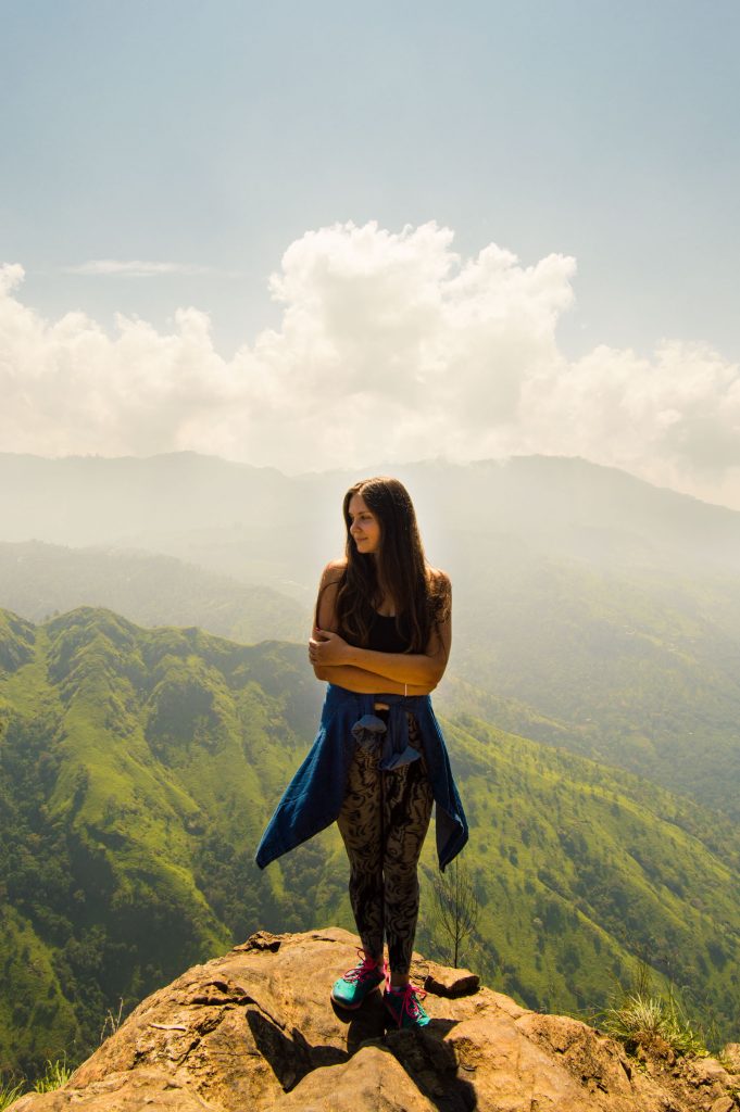
Between the ocean and mountains, I choose mountains every time. In Sri Lanka, where both are within a few hours drive from Colombo, my favorite place for adventurous hikes and magnificent views is Ella. A tiny hipster town in the middle of the hill country is surrounded by mountains on all sides. Probably the most popular hike in the area is up Ella Rock.
Although the place is touristy, the hiking trail is hard to find and, once you manage to do it, quite confusing. Start in Ella town by following the railway tracks southwards. After passing Kithaella train station you’ll see a turn to the left. This is where the trek goes into the wild and where local guides usually offer to take you to the summit. You can do it yourself too, but it will probably take more time and getting lost a few times, but it’s doable. For a fee of about RS 1500 ($10) a guide will show you the way up and down.
The path goes through tea plantations and forest and might get slippery. On my last hike to Ella Rock, I took the fast way down on my butt and broke my phone. So pro-tip: wear comfortable shoes. There’s a great viewpoint half way up. And then, of course, a majestic view from the summit.
Namsan Mountain, Gyeongju National Park, South Korea (Be Marie Travels)
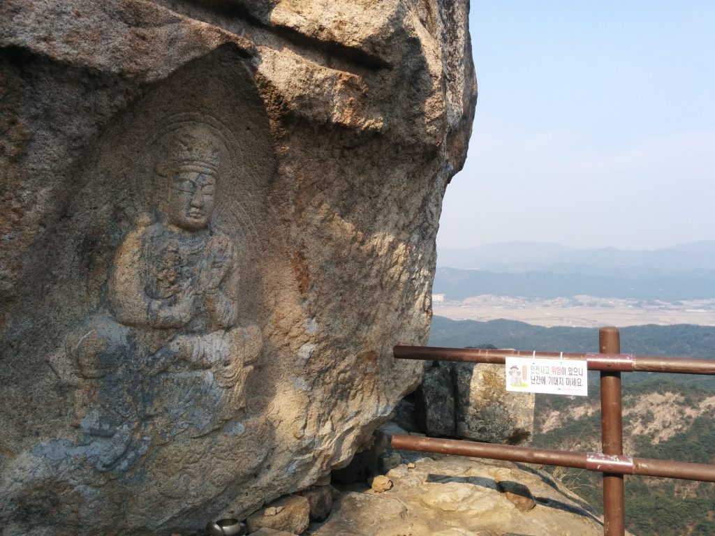
Gyeongju National Park exists out of 7 mountain, which goes all around the city, Gyeongju. It is the only historic national park in South Korea and one of the 7 mountains, namely Mount Namsan, is classified as UNESCO heritage since 2000. The 494-meter high mountain holds hundreds of Buddhist remains dating back to the 7th century during the Silla Dynasty. Remains that can be found on the mountain are pagodas, working temple and Buddha carvings/statues.
One of the most popular hiking routes is to the Seven Buddha’s Hermitage. The easy hike on a well-maintained mountain trail takes around 1,5h to complete. At the end of the hiking trail which is also the top of the mountain is a small temple, with a monk who serves tea to hikers, and seven rock-carved Buddha figures.
Wolchulsan National Park, South Korea (Meandering Amy)
When it comes to parks in South Korea, the most recognized one would have to be Namsan Park. This is due to the park’s location in Seoul. While Namsan Park offers beautiful views of Seoul, there are actually 22 National Parks in South Korea. Each park offers their own treat, ranging from mountainous parks to coastal parks.
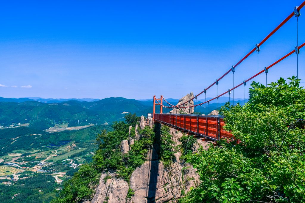
One of the best parks in South Korea and one of the most famous National Parks is Wolchulsan National Park. Located in the South West corner of South Korea in Jeollanam-do province. It is actually the smallest national park in South Korea at only 56km! However, a great feature in the national park is the famous “Cloud Bridge” or Gureumdari. This bridge connects two peaks and is famous for the bridge’s bright orange contrast compared to the mountain peaks behind it.
The hike to Cloud Bridge is classified as moderate to advanced – depending on what route you take! That is one of the great aspects of the hike is that there are options. If you are feeling adventurous, there is a route that involves large rocks and will require using your hands in order to pull yourself up. However, if you are not as adventurous then there is a stair route which is simply climbing up cases of stairs to the top. Both routes are the same distance of 1.5km, the difference is the method of the trail.
My recommendation is to just do the loop – therefore both trails. Take the rocky route up because going down a rocky uneven trail is killer on the feet and knees. It’s adventurous, and it’s fun! Then after enjoying the bridge and overlook, take the trail down the stairs. Overall, the trip is 3km and should take 3 hours depending on how long you enjoy the view at the top.
The bridge offers a beautiful photo opportunity for visitors, using the bright orange / red contrast against the blue and green mountains. The park is open early enough (4 am) or late enough (typically 2 hours after sunrise) to offer sunset or sunrise photography options. This mixed with an option for trails make it one of the more accessible hikes in South Korea! For accommodation, there is a campground at the start of the trail so there is the option to camp out the day before or the day following. Additionally, the location of the National Park is just an hour away from Mokpo, the city where you can grab a ferry over to Jeju Island aka “The Hawaii of South Korea”!
Ambrym’s Volcanoes, Vanuatu (The Lost Passport)
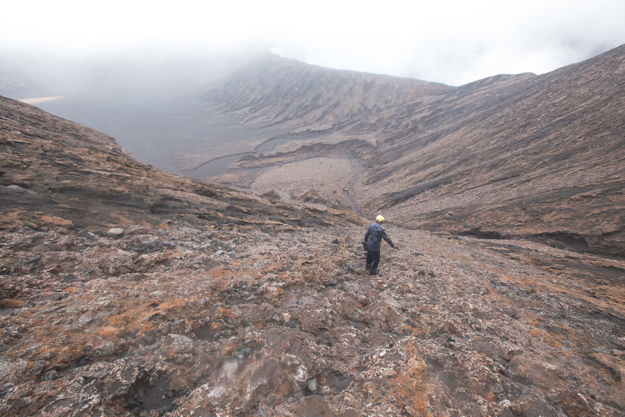
You cannot get much better than hiking through the jungle on a remote island of Vanuatu, to find not one, but two bubbling lava lakes. This is Ambrym, and it is totally amazing, definitely one of the best hikes in the world.
Ambrym lies around 130 north of Vanuatu’s capital city Port Via. It is an island covered in dense jungle, terrible condition roads, friendly people and two huge active volcanoes called Mount Benbow and Mount Marum.
A two-day hike up Ambrym’s volcanoes takes you from a small coastal town called Port Vatu, up steep mountains and through dense jungle to the volcanic ash plains. This is one of the most intensive hikes I’ve ever undertaken, a good 8/10 in difficult. Depending on the weather conditions, you will spend one to two nights camping out on the ash plains.
From the base camp, you will make day hikes to the crater of each volcano. Standing on the edge of an active volcano’s crater, and feeling the heat rise from the center of the earth, is an experience you will not forget. This inferno of bubbling lava down makes you realize the true force of nature.
Best hikes in the world: Africa and Middle-East
The Robberg Nature Reserve, South Africa (Wapiti Travel)
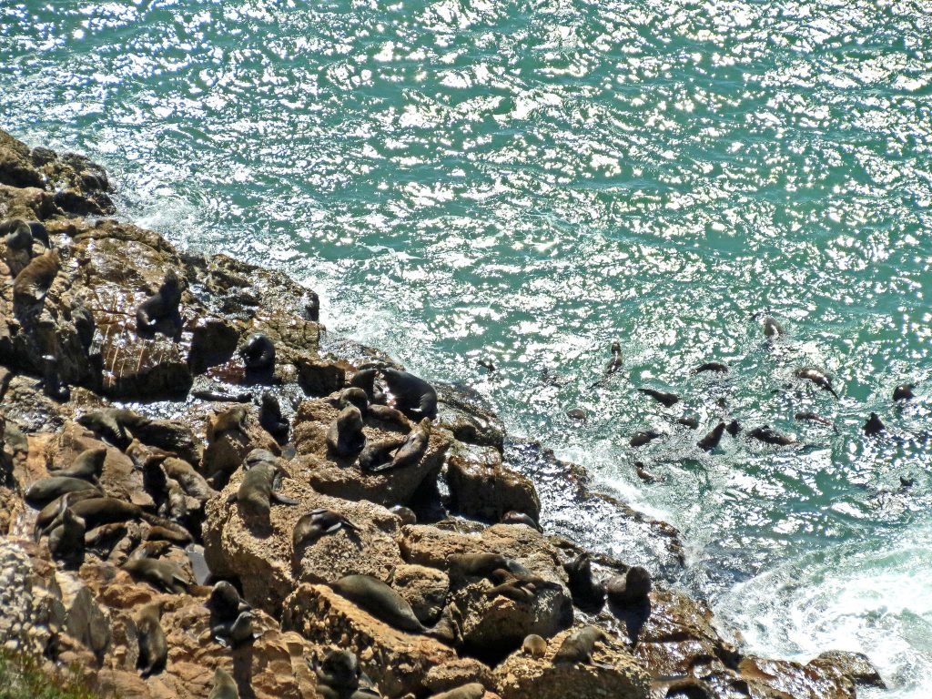
The Robberg Nature Reserve is located right next to Plettenberg Bay on the Famous Garden Route in South Africa. There’re many activities you can do in this area but be sure to reserve one day for a hike in the Robberg Nature Reserve, a national monument as well as a World Heritage Site.
During your hike, you may see dolphins and whales, sunbathing fur seals and you can enjoy the company of hundreds of gannets, cormorants, and even albatrosses.
You can choose from 3 hikes in the reserve. The longest, as well as most strenuous hike, is the one that follows the coastline until the extreme tip of the Peninsula called ‘The point’, from there onwards it loops back and it takes you all around the Peninsula. This hike is 11km long and takes at least 4 hours. I would advise reserving at least 6 hours if you would like to stop to enjoy the views along the way. The other 2 hikes are shortcuts of the first hike but will not bring you along the most spectacular point of the reserve.
Be sure to wear sturdy walking shoes and bring along enough water as well as some snacks. The walking path near ‘The Point’ and from this part onwards back to the beach can be tricky at points. You will be required to clamber over and between huge rocks and there’re some steep inclines and declines where you will be required to climb up or down with the help of a rope. This part of the hike is not recommended for your children.
Mount Kilimanjaro, Tanzania (Torn Tackies)
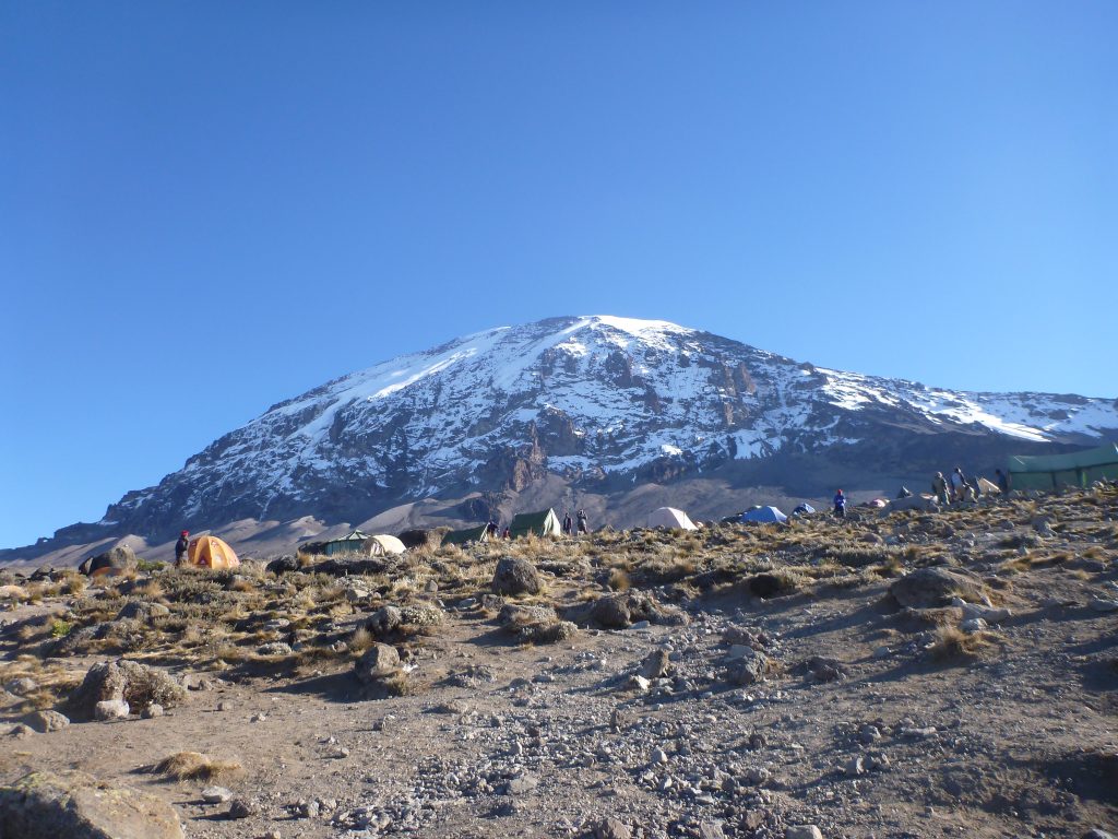
Tanzania is home to the highest mountain in Africa, Mount Kilimanjaro. If you’re looking to add a hike to your bucket list, then this one’s for you! Sitting at 5 895m, Mount Kilimanjaro is not only one of the seven summits, but also holds the title of the highest freestanding mountain in the world.
The route to the summit of Mount Kilimanjaro takes you through diverse landscapes which offer beautiful views and scenic surroundings. Your hike begins in a tropical rainforest which slowly transforms into grasslands filled with small shrubs. As you progress up the mountain, you make your way through an arid desert before reaching arctic conditions at the summit.
The summit itself is an achievable one with people of all ages and fitness levels reaching Uhuru Peak. It’s not a technical climb and requires no extensive training. However, altitude does play a factor and is the main reason people fail to reach the peak. This post will take you through everything you need to know when planning your trip. It’s advisable to do the 7-day hike to allow your body time to adjust to the higher altitude. And yes, it’s 7 days of camping which adds to the adventure.
Hiking Mount Kilimanjaro will test you both physically and emotionally. Personally, I live for these moments as they build character. Once you reach the peak you’ll wonder why you hadn’t climbed Kili sooner!
Udzungwa Mountains National Park, Tanzania (The Travel Blogs)
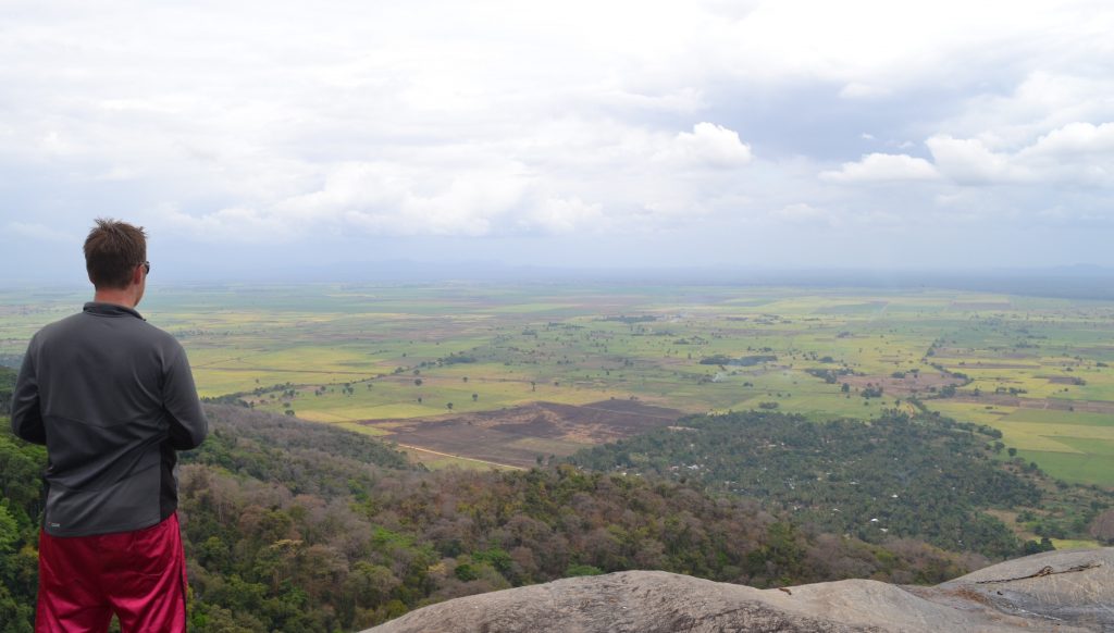
The camp of Hondo Hondo is an expansive site that is open for camping as well as having small huts that can be booked or a little extra comfort. Located on the fringes of the Udzungwa Mountains National Park, a small (by African standards) National Park in the south of Tanzania, it offers some amazing hikes and as it is a little off the beaten path, it still sits relatively undiscovered.
The hike has to be arranged with a guide before you go as the paths are not really marked and it would be very easy to get lost, however, the value they offer in regard to knowing where the best spots are and spotting local wildlife is well worth it. The most popular route is a 7 km hike up the 170m Sanje Waterfalls. Along the way you will pass through an amazing jungle and over fear-inducing bridges, more a safety fear than height related, seeing previous bridges below that had fallen down didn’t help the nerves. There is also an added bonus of two small waterfalls on the way to the top that you can take a dip in to cool off. Due to the condition of the route, the hike can be pretty rough going at times, but when you reach the top and stare out over the African Plains from atop, you will be sure it was worth the effort.
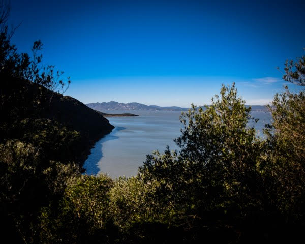
Lake Ichkeul, Tunisia (History Fangirl)
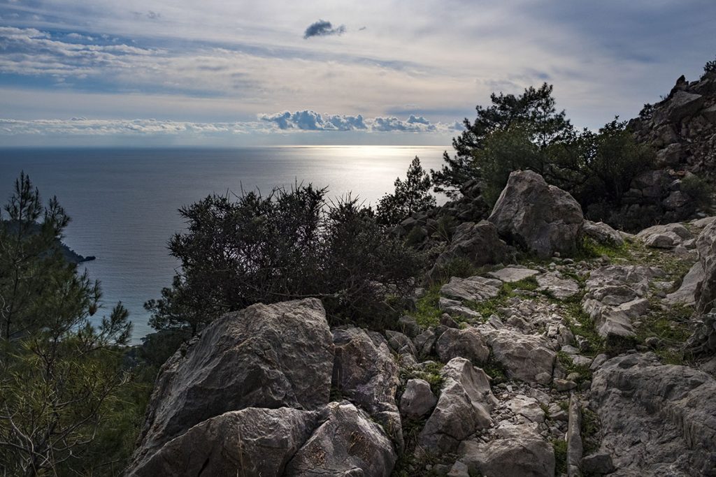
The Lycian Way, Turkey (Slow Travel Guide)
Best hikes in the world: Europe
Hiking Theth to Valbona, Albania (Travels of a Bookpacker)
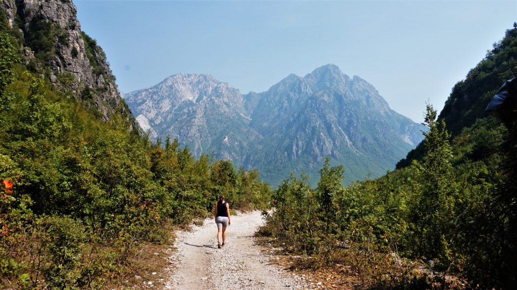
One of the most spectacular hikes we’ve encountered is the day-long hike from the gorgeous little town of Theth to Valbona National Park in the north of Albania. The hike is moderately challenging and leads you up one side of a mountain and down the other. The views from the highest point are simply stunning providing sweeping panoramas of the Albanian Alps.
The terrain varies and throughout the hike, you cross broad fields, weave through beautiful forests and pick your way down rocky mountainsides. There are a few conveniently placed small cafes along the route to get basic food and refreshments. This hike is a real hidden gem and while you’ll probably spot a couple of people along the path, there will be sections with no one else in sight. Leaving you to enjoy the amazing views in peace. Accommodation is available in both Theth and Valbona and a popular route is to take the ferry along the Komani Lake to return to the main city of Shkoder instead of doing the hike in reverse as well.
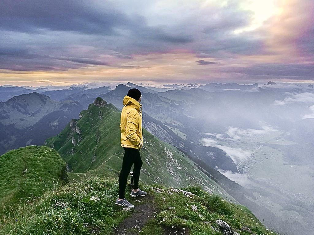
Sunrise Hiking at Kanisfluh, Austria (Love & Road)
Seven Rila Lakes, Bulgaria (Two Find a Way)
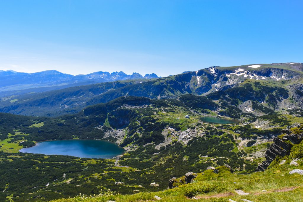
Bulgaria is still a hidden secret for many! To go along with its history and architecture, the country is also a paradise for nature lovers! Everything from some of the highest mountains in Europe, to the beautiful Black Sea. There really is an incredible amount of experiences waiting for you in this Balkan country. The hardest part is actually to choose! At least, it was for us. In the end, we were very happy with our choice and are eager to share it with you now. We are certain it is one the best hikes in the world! The hike to see the Seven Rila Lakes is magical and filled with breathtaking scenery.
Rila is the highest mountain range in all of the Balkans, located in southwestern Bulgaria. The area is filled with glacial lakes, the Seven Rila Lakes are the most famous. If you are looking for adventure and beautiful scenery but, like us, are just starting out and still far from experienced-hiker-level, this is the perfect choice for you. You can see the seven lakes in one day, and adjust the difficulty to your capabilities. Different trails have different difficulty levels, all of which offer staggering views.
We visited as a day trip from Sofia, but if you have more time, you can make it a longer adventure. There are many other hiking trails, both longer and more challenging. It is also worth spending a few days in Sapareva Baya, a nearby town located at the north foot of the Rila Mountain.
The Burren Way, Ireland (Your Irish Adventure)
Cinque Terre, Italy (Swedish Nomad)
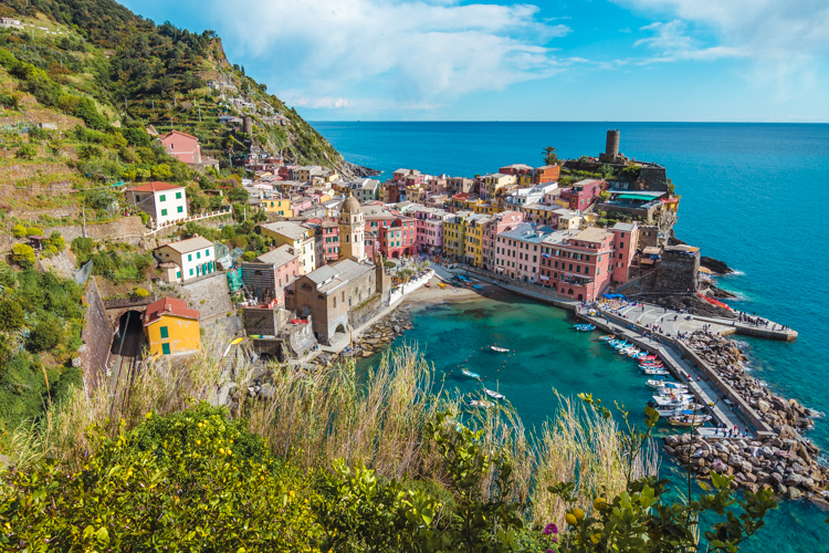
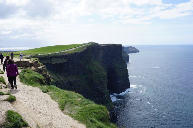
Cinque Terre is one of the most popular destinations in Italy, which is also known as the five lands or the five villages. Between the villages, you will find nice and scenic walking trails where you can go hiking. It’s the best way to experience Cinque Terre, and it’s something that I can highly recommend, especially in May or September, when there are fewer crowds.
There are various trails you can choose from. The standard ones between the villages are easy to moderate. So, for more advanced hikers I can recommend exploring the mountain villages as well. Those trails are quite challenging but no problem for experienced hikers.
What makes Cinque Terre one of the best hiking destinations in the world is the scenic views, delicious foods, picturesque villages and the relatively easy of walking the trails. It’s also a perfect stop to stay for 1-3 hours at each village and take a rest before you continue.
Monte Baldo, Italy (Ann the Adventurist)
Trolltunga Hike, Norway (7 continents 1 passport)
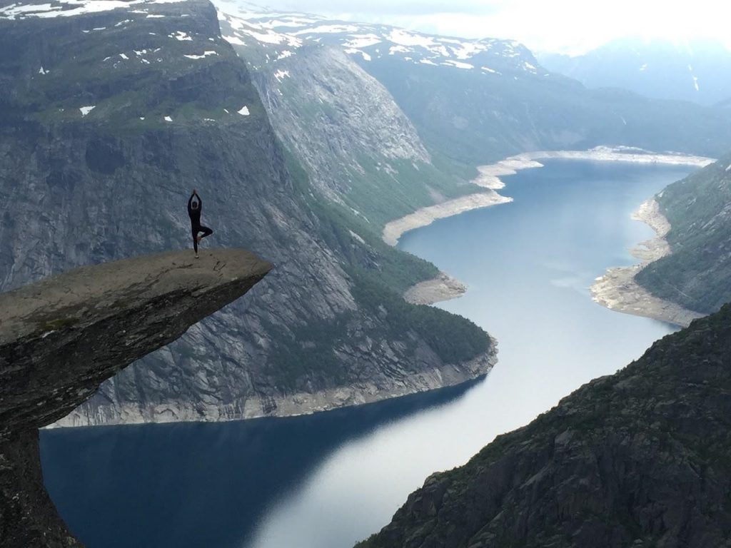
When I visited Norway for the first time in 2014, I did three of its best hikes three days, but the one I will do again in a heartbeat is Trolltunga.
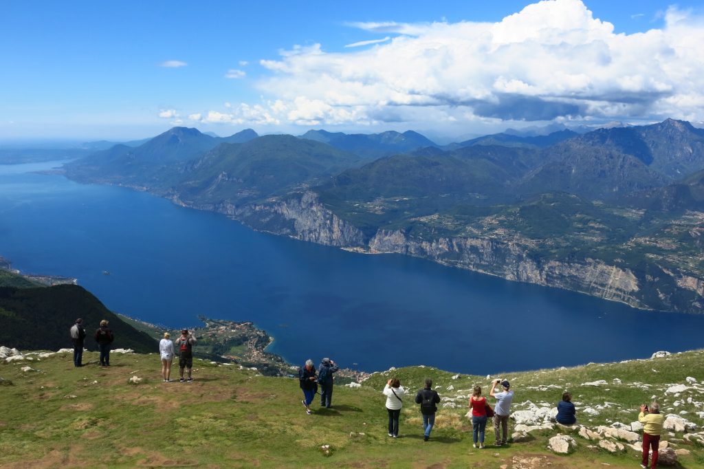
Trolltunga (Troll’s tongue) is a spectacular cliff jutting out horizontally 700m above a lake where you’ll get some of the most Instagrammable views in the world. It’s near the Skjeggedal area, about 10 km (6.2 mi) east of the villages of Tyssedal and Sørfjorden and 1250 m above sea level.
The hike is 22 km long (11 km each way), should take between 8 to 10h (4-5h each way) and the terrain can range from mud to rock and sometimes ice and snow. So, the best time to do this long and quite difficult hike is during the summer, from mid-June to mid-September.
What makes Trolltunga the best hike in Norway, apart from that astonishing cliff (and incredible potential Instagram post), is that throughout you will pass by many waterfalls and streams and some of the most magnificent scenic cliffs in the country.
Having reached the summit and standing on the tip of the Troll’s Tongue, ironically, I was completely speechless. The view of the Norwegian fjords with the snowcapped mountains and the dark blue lake underneath me was like nothing I’d ever seen before.
Trolltunga is something beyond magical and breathtaking. In fact, It’s a place that’s hard to believe exits. It’s something that everyone should do at least once.
Aescher cliff, Switzerland (Editaroundtheworld)
Mount Rigi, Switzerland (MSC Gerber)
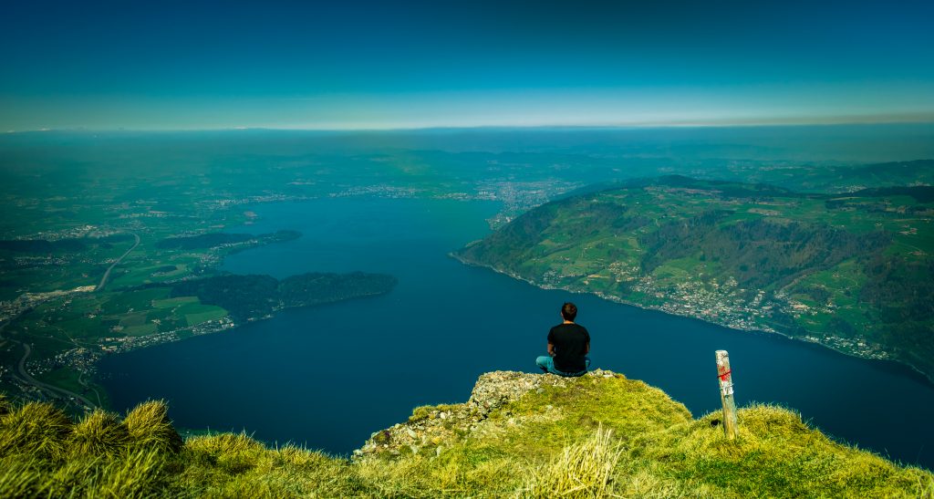
The mount Rigi, which is located in the middle of the Swiss Alps, is often called “Queen of the mountains” – and believe me, it absolutely earns this name. What makes it extremely special is that it’s basically surrounded by three different lakes: Lake Lucerne, Lake Zug, and Lake Lauerz. It’s also served by Europe’s oldest mountain railways and is a symbol for Switzerland’s role as a pioneer in mountain railways.
While it is amazing to get up to Mount Rigi by train it’s even more rewarding to make your way up there on your own – earning one of the most incredible views in whole Switzerland. And the best thing about it: There is a hike for everybody, no matter if you are a complete beginner or an experienced adventurer. You can choose different routes ranging from 30 minutes up to several hours.
No wonder that famous artists like Mark Twain or Johann Wolfgang von Goethe already discovered this beautiful place in the past. There are even two special routes that were created in honor of these two artists – a perfect combination of history, art, and Swiss nature.
If you ever stay in Switzerland, especially in Lucerne, which is nearby Mount Rigi, you should definitely hike up to the Queen of the mountains.
South West Coast Path, UK (Coddiwomp)
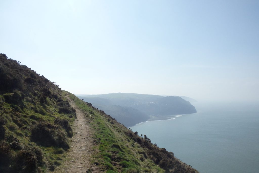
The South West Coast Path is a 630-mile hike around, you guessed it, the south-west coast of England.
From Minehead, in Somerset, all the way to Poole in Dorset, it is one of the most well-known hikes in the UK and is famous all over the world for its immense natural beauty, meandering coastal trails, heritage, ancient landmarks and gorgeous (and quintessentially English) coastal villages.
The hike passes through all manner of bizarre and mysteriously named places, including Lizard’s Point and Land’s End. Places such as these are steeped in history, and the walk takes you right through the middle of it all.
A fun fact for you. If you walk it from start to finish you’ll have climbed (apparently) 114,931 feet. That’s four times the height of Mount Everest. Not bad for a coastal walk eh? However, most people do the walk in sections, picking and choosing to do part of the hike whenever they have some time.
If you have eight weeks free and some sturdy boots on your feet, then join the mad hatters that go from start to finish in one go each year. It’s something of a pilgrimage and an exceptional feat. There are different difficulties, from sections suitable for families of all ages to parts that’ll stretch even the fittest of individuals.
People hike the SWCP all year round, but for decent weather and relatively quitter trails (compared to summer) head there in springtime.
Best hikes in the world: North-America
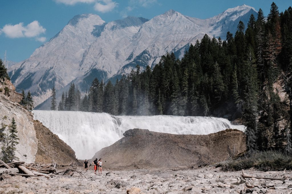
Yoho National Park, British Columbia, Canada (Mint Habits)
Tonquin Valley Hike, Jasper National Park, Canada (Zen Travellers)
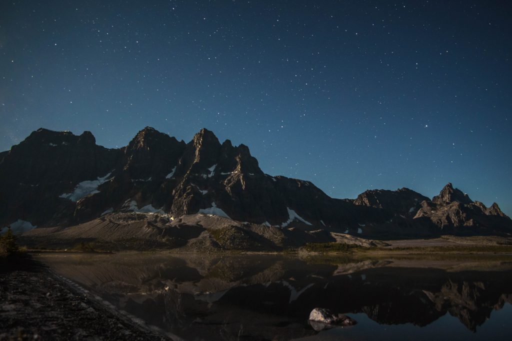
The Tonquin Valley hike in Jasper National Park in Alberta, Canada has it all. From soaring, jagged peaks, to larger than life landscapes, serene alpine lakes, and the chance to see a wide range of wildlife, including the endangered woodland caribou, there is something for everyone.
There a few different ways to the multi-day hike and it can be completed in a loop, but I recommend going out and back from the Portal Creek trailhead. This way you will get to walk through the incredibly beautiful Maccarib Pass twice. In the height of the summer, there can be lots of bugs, so it’s best hiked at the end of August to mid-September. Just be prepared for very cold nights!
The majestic and otherworldly Amethyst Lake can be reached after a 23km steep, but not gruelling hike in, and there are 2 campgrounds along the way if you want to split up the trip in. Once at Amethyst Lake, the views of the Ramparts jutting out of the glacier-fed lake will take your breath away, and a nearby meadow is a favorite place for caribou to visit in the early morning. At night, you can take in the endlessly starry night skies and hear the nearby glaciers calving, sending chunks of ice crashing into the lake. I spent two days at the campground and enjoyed touring the area. There are plenty of hiking trails, summits, and technical climbs that can be reached using Amethyst Lake campground as a base.
Those wanting to do a thru-hike can arrange for a car to pick them up at the Astoria Creek trailhead, but again I think Maccarib Pass is worth a second look.
Other things to consider are that you will need to get a backcountry permit through the Parks Canada website and practice principles of Leave No Trace. This means packing out absolutely everything that you brought in, not starting fires when there’s a fire ban, staying on the boardwalks, and keeping a respectful distance from wildlife. Tonquin Valley is such a wild and beautiful area it needs to be protected so it can be enjoyed by many for years to come.
Kalaupapa, Hawaii, USA (The Mormon Adventurista)
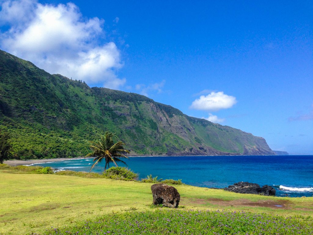
- The only way to hike the Kalaupapa Trail is to book a tour of the Kalaupapa Settlement with Damien Tours, a private commercial tour company. Total cost as of 2018 is $80 for hike permit, sack lunch, and an educational tour of the Settlement.
- Since the Kalaupapa Settlement is still an active leper colony, nobody under the age of 16 is permitted to enter.
- The trail is in a literal jungle and is shaded, and heavy boots aren’t required. I’d recommend trekking poles if you want to save your knees and ankles.
- Bring water!
Koko Head Crater Trail, Oahu, Hawaii, USA (Free Two Roam)
Lanikai Pillbox Hike on Oahu, Hawaii, USA (Borders & Bucket Lists)
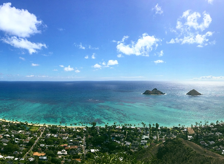
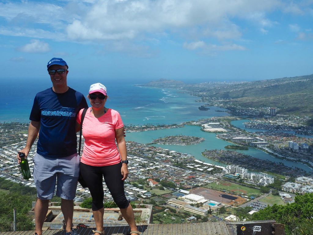
When I decide if I like a hike or not, I like to think of it in terms of an effort-to-reward ratio. In other words, how much effort do I have to put in for the reward I get? And is that amount of effort worth it? In my mind, the Lanikai Pillbox hike has a fantastic effort-to-reward ratio.
Although I wouldn’t say I’m a great hiker, I was able to complete this hike in less than half an hour. Granted, it is quite steep. Don’t let the first couple hundred feet stop you from attempting this hike though! That’s definitely the hardest part. Once you push through that, take a break at the little outlook where you can get your first glimpse of the “mokes” (that’s what locals call the two islands you’ll be able to see).
I usually choose to end my hike at the first World War II pillbox, an old cement military bunker covered with colorful graffiti. From there, you can get a great breeze from the island winds and a stunning view of the mokes. However, you can also continue for another ten minutes to the second pillbox for a similar view, perhaps with fewer people.
Before going on this hike, be sure to check that it is open. There has been news going around the islands that the hike will be under construction at some point. When that will be is unclear.
Happy hiking!
Waipi’o Valley, Hawaii, USA (The Misguided Millennial)
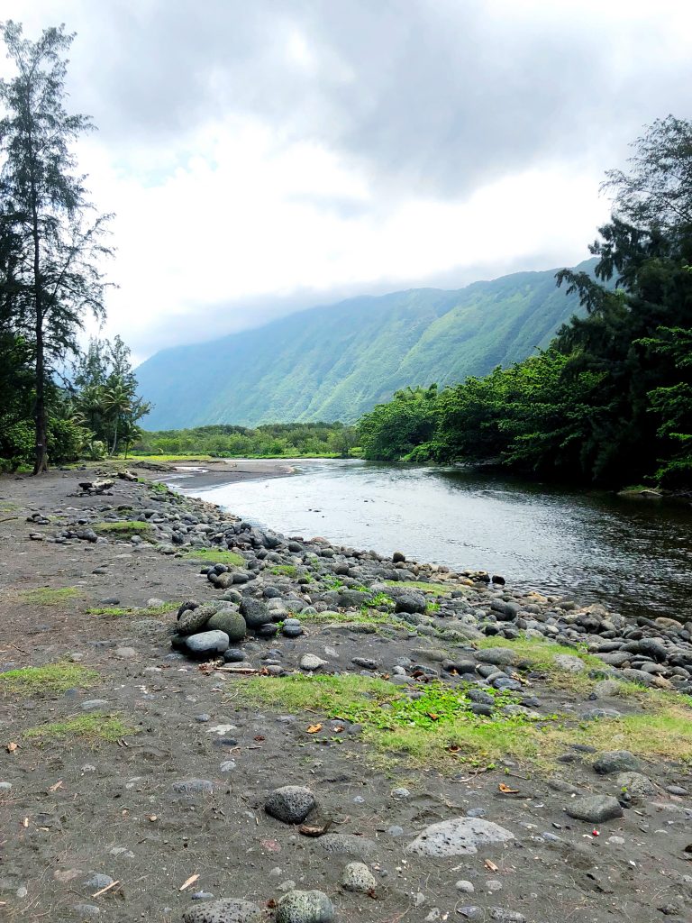
This hike is not for beginners but is one of the most beautiful hikes I have ever done. The almost 1000-foot elevation change is concentrated in the first mile of the hike down. This means it is very steep and a bit rough on the knees. We did 3 hikes on my trip to the Big Island and Waipi’o Valley the most difficult even though it was not the longest. You do have the option to drive down to the valley if you have a 4WD vehicle, but we opted to hike and began the difficult descent to the valley. It may be hard on the way down (and certainly the way back up) but once you reach the valley, it is so beautiful that words have failed me!
Kilauea Iki Trail, Hawaii (CosmopoliClan)
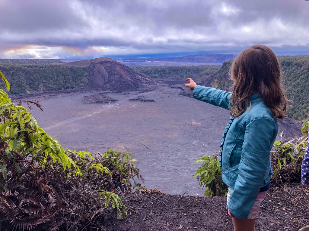
The 4-mile Kilauea Iki Trail hike first takes you through the lush rainforest around this side-crater of the famous Kilauea volcano on Hawaii’s Big Island. Different viewpoints give you the chance to peak through the trees and see the crater. The path starts out pretty easy and winds down once you get closer to the crater floor. At that point, it gets more challenging because of the lava rocks and slippery steps. When you reach the crater floor and pass the rocky edge, the surface becomes very smooth. There’s no trail inside the crater and hikers are instructed to follow the stacks of rocks. Massive cracks and steam vents clearly indicate the volcano’s ongoing activity. When you touch the crater floor, you can literally feel the heat. It’s such a fascinating experience! When you finish crossing the crater, it’s time to climb your way up again. This trail makes for a very easy hike all the way up to the second parking lot. Crossing it leads you to the Thurston Lava Tube which is just a small detour and well worth the effort. A final part of the trail will lead you to the primary parking lot.
We’re no experienced hikers and still managed to complete this trail in 3 hours as a family of four (our kids are 8 and 6). It did push our limits but we’re so proud to have persevered. Even more so because we were there just a few weeks before the volcano eruption, making this challenging hike a very memorable one.
Kalalau Trail, Hawaii, USA (This Big Wild World)
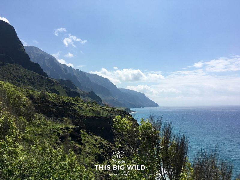
The Kalalau Trail, in Kauai, wraps along the Na Pali coast for eleven miles and is only accessible by foot. It’s a remote paradise for advanced hikers.
The trail ends at the secluded Kalalau Beach, but reaching this magical place doesn’t come without risk. You’ll cross several streams, navigate narrow ledges along steep cliffs and be at the mercy of Mother Nature as flashfloods frequent this westernmost edge of the island.
Long before you arrive in Kauai, be sure to secure a hiking permit. These are required beyond Hanakapi-ai Beach at mile 2 and enforced. If you can’t secure a permit, try the alternative day hike to Hanakapi-ai Falls.
There are a few things to know about this hike. Save on pack weight by refilling water at the streams along the trail, but be sure to treat it first. Depart from the trailhead at Ke’e Beach before 7 am to avoid both the heat and the crowd. Hanakoa campsite is near the halfway point, making it a great option to enjoy lunch along the stream. Collect your thoughts there because shortly after Hanakoa, you’ll reach a series of ledges. The most notorious is Crawler’s Ledge, a 12-18 inch wide ledge with a steep drop down into the water.
All of this hard work is worth it when you get your first glimpse at Kalalau Beach. Enjoy the last 2 miles downhill into the campsite, rinse off in the nearby waterfall and enjoy an amazing sunset from the beach.
The Kalalau Trail is a challenge, for sure, but those who have hiked it, myself included, will say it changes you.
Angels Landing, Zion National Park, USA (Oz and Other Places)
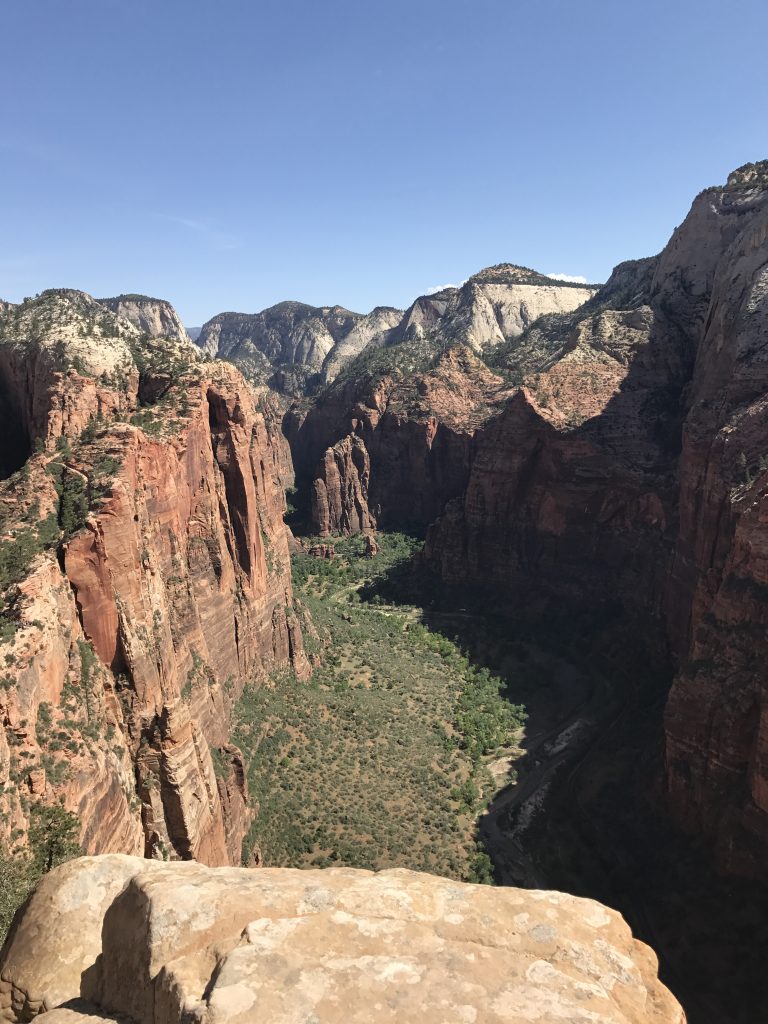
Angels Landing at Zion National Park in Utah is one of my favorite hikes in the world! Supposedly, it got its name from an explorer in the early 1900s who said: “Only an angel could land on it!” And although thousands of hikers “land” here every year, I completely understand what he meant. Overall Angels Landing is a 5-mile round trip hike that’s rated strenuous. It is broken up into three main parts: West Rim Trail and Refrigerator Canyon, Walter’s Wiggles which are a series of 21 tight switchbacks, followed by the ridge portion.
The first two legs of the hike are beautiful in their own right as you work your way up to Scout’s Lookout. You’ll walk along the river and through rock walls while gaining over 1000 ft in elevation. Scout’s Lookout offers an incredible view of the park. From here you can see the Narrows and the winding Virgin River. If you’re not great with heights, this is a good place to stop. However, the most exciting part for me was the ridge! The last half mile of the hike (one way) is a narrow sandstone path with extremely steep drop-offs on either side. There is a chain to hold onto but no other safety guards, so you’ll want to be careful and take your time. I recommend going as early as possible to avoid the crowds (and the Utah heat). But I promise the breathtaking views at the end and the thrill of getting out there is well worth it!!
South Sister, Oregon, USA (Where in the World is Nina?)
Tumbledown Mountain, Maine, USA (The Daily Adventures of Me)
The South Rim Trail, Big Bend National Park, USA (Sol Salute)
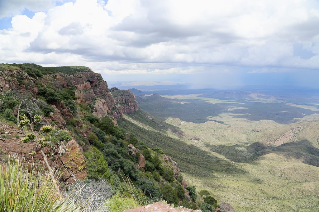
.Big Bend National Park isn’t on most people’s radars, but every avid hiker should go there, immediately. There are over 150 miles of hiking trails in Big Bend. Some trails traverse canyons, others the desert, but the epitome of Big Bend hikes is the South Rim Trail in the Chisos Mountains. This loop trail takes an entire day. Many actually choose to camp at one of the many first come first serve campsites dotting the trail. It’s a tempting offer: camping at the edge of a cliff, overlooking Mexico and the expansive Chihuahuan Desert, sleeping underneath the Milky Way.
I, however, am no camper. My husband and I decided to tackle the South Rim as a day hike. Backpacks filled with liters of water (summer in Big Bend is no joke), sandwiches and snacks, off we went. I was a bit nervous. I’d never conquered such a long hike before. But there’s no need to be nervous, while it’s a long hike, it’s not skillfully challenging. If you’re in good shape, you’ll be fine. It took us nearly eight hours to complete the hike, but we stopped a lot to catch our breath and to take in the views, which are breathtaking.
The highlight of the South Rim is its namesake, the south rim of the Chisos Mountains. We stopped here for lunch, sitting on the edge of the cliff watching three separate thunderstorms rain down over the Mexican desert. This hike is an absolute must!
Ozette Loop, Olympic National Park, USA (Happiest Outdoors)
Dream Lake trail, Rocky Mountain National Park, USA (Nomad by Trade)
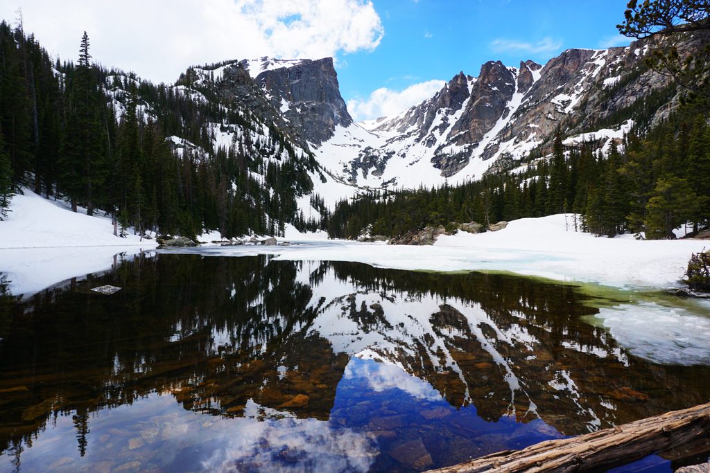
The Dream Lake trail in Rocky Mountain National Park in Colorado is one of my favorite hikes of all time. It’s moderately difficult, meaning that hikers at most levels of ability will be able to handle it and you’re treated to beautiful mountain views every step of the way. The endpoint – Dream Lake – is a small alpine lake with impossibly still water that serves as a mirror for the rugged peaks behind it. At approximately 2 miles each way, it can easily be fit into a half day hike, or you can continue further to explore more of the area.
Trans-Catalina Trail Hike, USA (She Dreams of Alpine)
Best hikes in the world: South-America
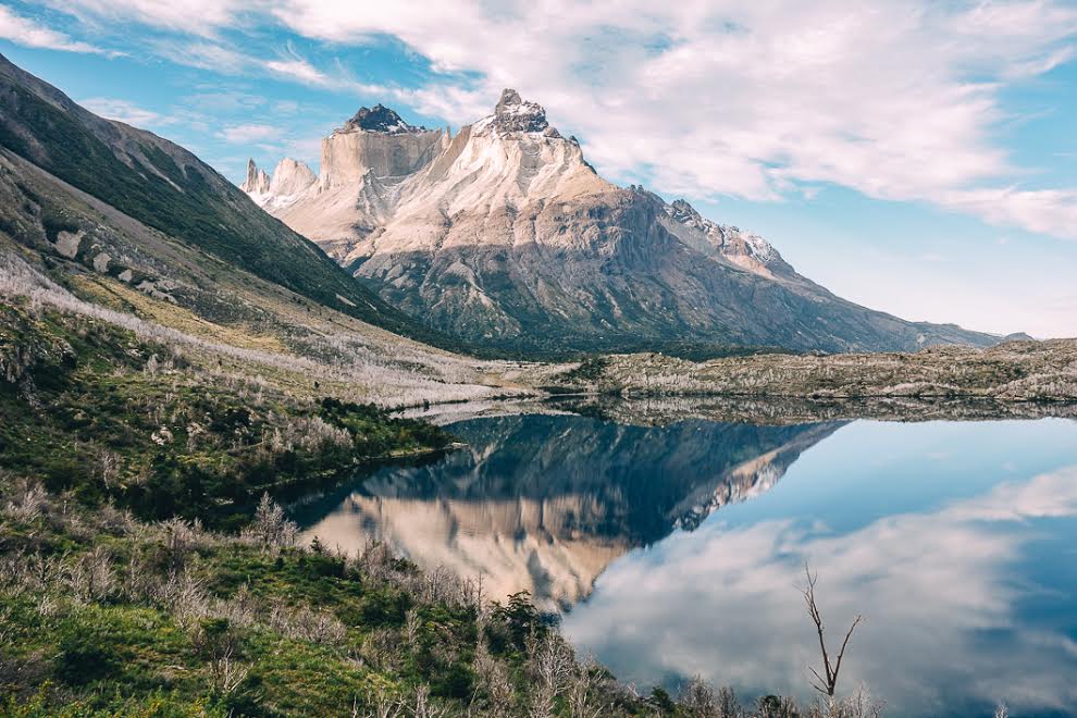
Torres Del Paine, Chile (The Wandering Queen)
Cocora Valley, Colombia (Our Escape Clause)
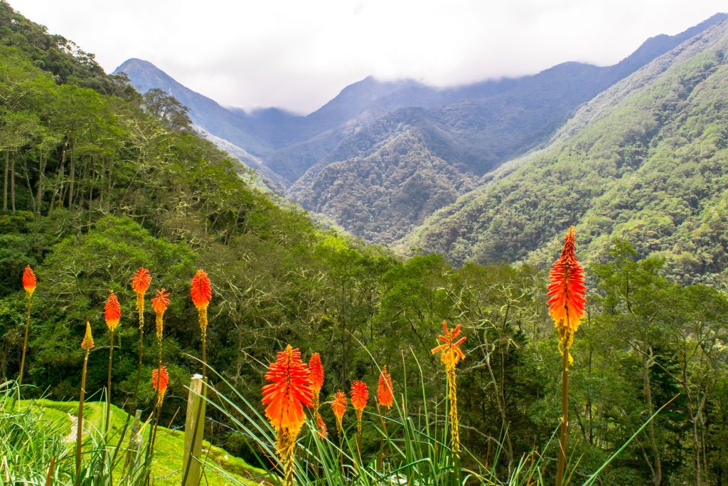
Hiking in the Cocora Valley of Colombia is a bit like entering another planet: imagine Ireland meets The Lorax, and you’ll have a vague approximation of what it is like to stare out over the vividly green valley with hundreds of wax palms (the tallest palm trees in the world!) reaching to the heavens.
Without a doubt, hiking the Cocora Valley is one of the most memorable moments from our month traveling through Colombia, and we would recommend anyone visiting the country to add it to their itinerary.
The standard loop hike that is popular in the Cocora Valley takes roughly 4-5 hours, with an optional one-hour add-on if you hike a bit out of the way to visit a hummingbird farm and grab a cup of coffee at their cafe.
Though the hike involves quite a few inclines and some mud, we would rate it as intermediate at worst–we are far from star athletes, and we found the hike invigorating but not insanely difficult (fair warning, though–we hear that after rainstorms the mud on the first part of the hike can be tough to deal with, so try to head out on a dry morning).
The Quilotoa Loop, Ecuador (Kic Travels)
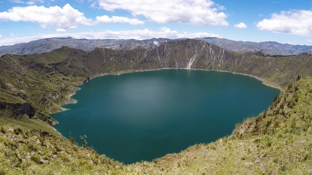
The Quilotoa Loop is a spectacular hike through the central highlands of Ecuador. Hiking the Loop takes around 3-4 days. It can be done in either direction but most people start in Sigchos and finish at Quilotoa. The first 2 days are spent walking through gorgeous green valleys, past bubbling brooks and rolling hills. The reward on the third day is reaching the crater of the Quilotoa Lake. At over 4000m above sea level this volcanic lake is quite a spectacle. On a clear day, you can spot some of the famous peaks such as Cotopaxi and Chimborazo from the crater rim.
Alongside the magnificent scenery, one of the other highlights is the strategically placed hostels along the way. They all know exactly what a tired hiker is after, offering hot meals, comfy beds and warm fires by which you can dry your clothes. This also means you don’t have to worry about carrying your own food and you don’t need a tent.
For anyone with a reasonable level of fitness, it’s not an overly challenging hike, but it does involve a lot of hills. We walked for 4 – 6 hours each day. The route is well marked and you’re never too far from a friendly local willing to point you in the right direction.
Salkantay Trail, Peru (Life of Doing)
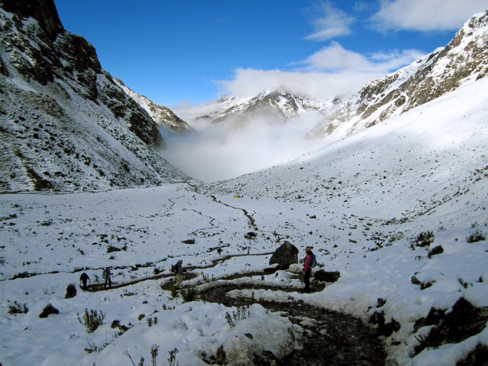
The Salkantay Trail is a great alternative to the Inca Trail which leads you to the famous UNESCO World Heritage Site, Machu Picchu, in Peru. Depending on your schedule, you can take 3 days or up to 8 days to complete the trek. We took a 5 days/4 nights with our tour group, two guides, horseman, and cook. The route started in Cusco and was over 60km (37 miles). The hike is challenging due to the high altitude and 6-8 hours of hiking each day.
We enjoyed the various landscapes along the trail and overnight camping for three nights. The first two days had luscious green trees, rolling hills, and the snow-capped Salkantay mountain. We weren’t prepared for the mountain’s peak at 4600m (15091 feet) and the cold weather but hiked up slowly. The third and fourth day was lovely as we walked through the valley, coffee plantations, and rainforest. Once we reached Aguas Calientes, the main town before Machu Picchu, it felt good to relax at the hostel.
It was exciting to finally reach Machu Picchu, the ancient Inca city. We left at 4:30 am to hike 1.5 hours to the entrance (or the alternative was to take a bus). It was a huge milestone to see the picturesque Machu Picchu for ourselves and learn about how life was like for the Incas. We would love to do this hike again, especially since our tour group team members did an awesome job caring for us.
Mount Roraima, Venezuela (My Turn to Travel)
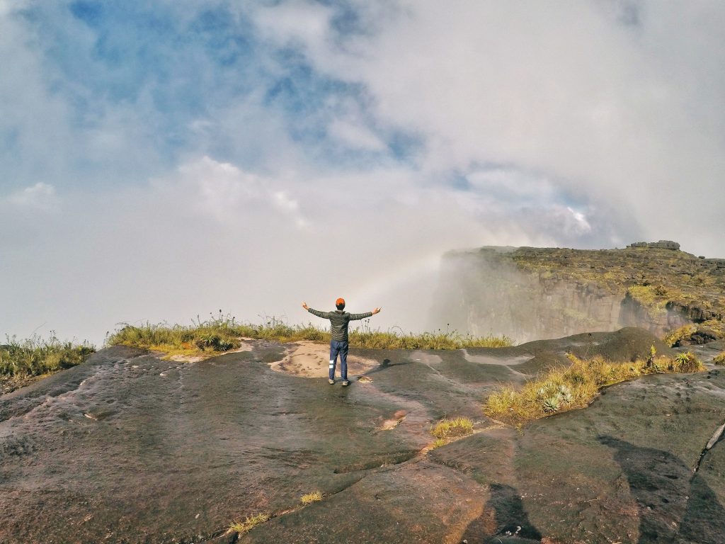
Mount Roraima is a table-top mountain of which the majority is in Venezuela, but also shared with Brazil and Guyana. What makes Mount Roraima one of the best hikes is that unlike other mountains, the summit is just the beginning.
As a tabletop mountain, the summit is like an island; with its own ecosystem of carnivorous plants, streams, waterfalls and giant pit holes. It even has its own microclimate!
What stood out for me is the landscape atop the summit. With black sandstone terrain, wet swampy marsh and weird rock formations, it looks like another world. In fact, Mount Roraima was the inspiration for Sir Arthur Conan Doyle’s ‘The Lost World’.
The Mount Roraima trek ranges from 6 to 8 days, with the difference being the number of days spent exploring the summit (it’s 31 square-kilometers!). It is a challenging trek as certain sections are steep, the summit terrain is knee-pounding, you’ll cross gushing rivers and walk under waterfalls. The climate is unpredictable; especially at 2810m where clouds drift in and out of your campsite.
However, when you make it up to the summit, you’ll definitely feel a sense of achievement. The highlight would be getting to the Triple Point where you get to be at 3 countries at once!
Did you do one of these best hikes in the world?
Some of these links are affiliate links. If you buy something through these links, Travel Eat Enjoy Repeat will earn a small commission. This will cost you nothing extra.
Such an amazing list of hikes! So much inspiration for a hiking addict! Look forward to ticking a few off 🙂
Thank you for your amazing recommendations. I am a kind of adventurous person, and I love hiking. I went to Tiger’s Net two years ago for a volunteer trip, and I have to say it was just wow. Having seen your list, I will definitely go visit all of the places you recommend. Thank you so much!